

Sometimes weather talk can feel like a maze before a hike. We know what you mean. Checking METAR (a current weather report), TAF (a forecast report), and wind speeds can be confusing at first. But when you learn these simple terms, you can plan safer trips. This guide explains everything in plain language so you know exactly what to expect. Once you understand the basics, you'll be all set to protect yourself and enjoy your hut-to-hut adventure with confidence.
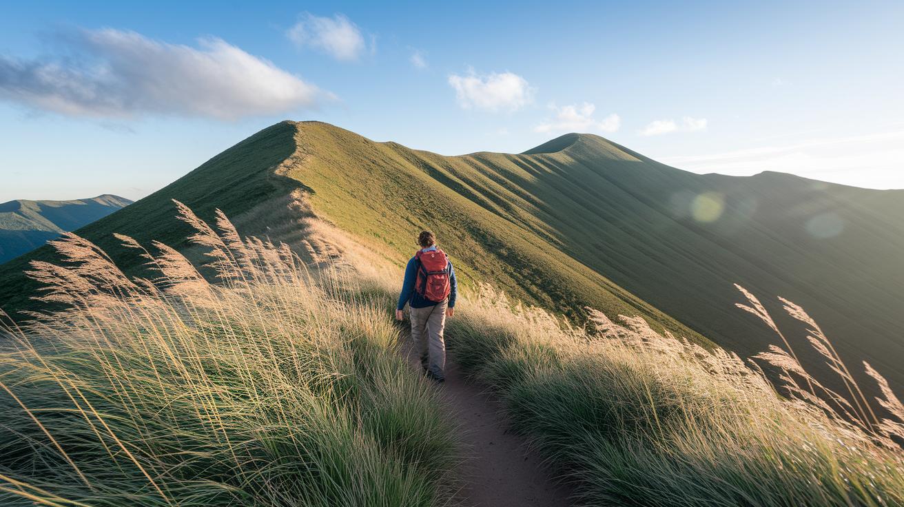
Essential Weather Briefing Terminology for Hikers

METAR is an hourly report that shows current weather conditions. It’s a quick way to see what the weather is like right now. For instance, a METAR might say that the sky is clear above a mountain lodge, which helps you decide if you need an extra layer.
TAF delivers a forecast updated every 6 hours and offers a 24-30 hour outlook. Imagine checking the TAF before your hut-to-hut trip to see if rain might fall during your overnight stay. This report is a handy guide for keeping your plans on track.
Precipitation probability is given as a percentage, say, 30%. This means any spot in the area might get at least 0.25 mm (0.01 inches) of rain. In mountain areas, a 30% chance in the valley might actually mean that half the mountain sees rain, with chances often rising to 50-60%.
Visibility scales tell you how far you can see clearly. If a report mentions 10 miles of clear sight (about 16 km), you can better plan your route and pace. Along with visibility, dew point and humidity readings show how moist the air is, which can make warm sunshine feel cooler.
The UV index shows the strength of the sun’s rays. When the UV level is high, be sure to use extra sun protection. For more weather tools, check out our hiking safety tools at https://hike2hut.com?p=155. This guide gives you the essential weather terms needed to plan safe and informed mountain trips.
Decoding Wind Metrics in Hiker-Focused Weather Briefings
When you’re out on the trail, knowing how the wind behaves can keep you safe. Weather reports show two numbers: the average wind speed and gusts, which are short bursts of stronger wind. For example, if the report says 10 mph on average with gusts up to 25 mph, it means that conditions can change quickly, especially in open spots.
The Beaufort Scale breaks wind into categories from 0 to 12. Force 6 means winds of 22–27 mph. On days with Force 6 winds, even experienced hikers may feel the strong push on rocky ridges. A higher number means the wind can hit you harder and change without warning.
Wind chill tells you how cold the air feels because of the wind. In high country, wind chill can make a mild day feel much colder. This extra chill can increase the risk for frostbite or hypothermia, so it’s important to dress warmly when winds pick up.
- Mean wind speed shows steady conditions, while gusts reveal sudden bursts.
- The Beaufort Scale gives a clear picture of how strong the wind might seem on the trail.
- Wind chill is a reminder to add extra layers to protect against the cold.
Understanding Precipitation Intensity and Snow Accumulation Terms for Hikers

Weather forecasts use simple words to help you know what to expect on the trail. The chance of precipitation tells you if you might get rain or snow, while the intensity word shows if it will be light, moderate, or heavy. Light rain might only dampen your gear a bit, but heavy rain can make rocks slick and the trail muddy.
The freezing level is a key term to watch. During heavy weather, it can be about 300–600 m (1,000–2,000 ft) below the top of the snow line. This means that rain higher up can turn to snow or sleet as you go lower. Knowing this helps you pack extra warm clothes and gear for sudden chills.
Snow accumulation is measured in centimeters or inches. Even a little snow can change how the trail feels and may bring avalanche risks. Words like “moderate accumulation” or “heavy accumulation” hint at deeper snow and the possible need for extra equipment such as microspikes on icy sections.
- Precipitation probability versus intensity: A 30% chance of rain may seem low but might still make parts of the trail wet.
- The freezing level tells you where rain can quickly change to snow.
- Snow accumulation figures help you decide if the trail will be slippery or if avalanche worries call for extra gear.
Identifying Pressure Systems and Fronts in Hiker Weather Forecasts

High-pressure areas, shown with an H on weather maps, mean clear skies and calm weather – great for hitting the trails. Low-pressure zones, marked by an L, hint at changing weather. When you see the pressure drop, expect thicker clouds and a bit more wind. This usually means a weather front is moving through.
Different fronts bring different changes. A cold front brings cooler air and often kicks up strong gusts. After one passes, you might feel a sudden chill and notice wind sweeping over a ridge. A warm front warms things up slowly and can bring light, steady rain. An occluded front blends warm and cold air, which may lead to mixed weather and shifting winds.
- High-pressure: Clear, calm days perfect for hiking.
- Low-pressure: Unsteady weather with chances of rain, fog, or even snow.
- Cold front: Quick drops in temperature and gusty winds.
- Warm front: Gradual warmth with steady, light rain.
- Occluded front: A mix of conditions with variable precipitation.
Keep these pointers in mind as you check your weather forecast to plan safe and enjoyable trips in the mountains.
Interpreting Weather Maps, Radar, and Symbols as a Hiker

Surface weather maps show a mix of symbols that hint at what weather to expect. A letter H means high pressure, usually giving you clear skies. An L stands for low pressure, which can bring clouds, rain, or fog. Isobars (lines linking spots with the same pressure) help you see if the atmosphere is calm or shifting. Wind barbs tell you the wind’s speed and direction so you can quickly spot gusty spots. Frontal boundaries mark where different air masses meet, and that often signals a change in the weather.
Radar and satellite images are great for tracking rain or snow as they happen. They reveal echoes that show where precipitation falls, helping you understand both its strength and motion along your route. For example, if you see echoes of rain moving toward your trail, it might be wise to adjust your plan.
- H shows stable high-pressure weather that is great for hiking.
- L warns of low-pressure conditions that might bring clouds or rain.
- Wind barbs give you a quick look at the current wind speeds and gusts.
Digital tools like the gps hiking app provide up-to-date radar and satellite information. But in remote areas, your smartphone’s signal might drop out. That's why it’s smart to use both digital tools and a traditional map with a compass. Always check what the digital data shows against your map. If you see heavy rain on the radar and the map shows a frontal boundary nearby, use both tips to steer clear of any potential hazards on your trail.
Applying Weather Forecast Terminology for Hiker Safety and Planning

Knowing weather codes is key when planning a safe mountain hike. Weather reports warn you about heavy rain, strong winds, or avalanche risks. For example, last year there were many mountain rescue calls in England, Wales, and Scotland. That shows why it’s important to check the forecast and adjust your plans if needed.
Weather updates also point out thunderstorm risks. Terms like lightning, gusts, and hail mean conditions might turn dangerous fast. A warning about shifting winds tells you that exposed trail parts may feel much colder from wind chill. This helps you decide if you need extra layers or windproof gear. You might even want to change your route or delay your start if the weather is about to change quickly.
Avalanche safety codes are just as important. Bulletins from MWIS or SAIS mark high-risk spots in winter and spring. These alerts help you pick safer paths, pack the right snow gear, or postpone your trip if risks are too high.
Here are some quick tips:
- Look for alerts about heavy rain and strong winds.
- Check avalanche bulletins from MWIS or SAIS.
- Watch for thunderstorm warnings mentioning lightning, gusts, and hail.
- Adjust your route and gear based on the forecast.
For more details on planning against weather hazards, check our hiking safety tips.
Final Words
In the action, the guide broke down essential weather terms, from METAR and TAF to wind metrics, precipitation intensity, pressure systems, and radar symbols. It shows how understanding weather briefing terminology for hikers can boost your safety when planning and on the trail.
Clear explanations help you read forecasts, prepare for hazards, and adjust your plans, keeping you safe and comfortable. Enjoy the clarity of real mountain weather details and have a great time exploring the trail.
FAQ
Frequently Asked Questions
What does weather briefing terminology mean for hikers?
Weather briefing terminology explains forecast terms like METAR, TAF, visibility, and UV index. These terms help you understand current sky conditions and plan for upcoming weather on the trail.
What can UK mountain weather and climate tell hikers?
UK mountain weather is changeable and cool. Forecasts highlight shifts in temperature, wind, and precipitation that help you choose gear and adjust your route for safe hiking.
Are tunnel tents good in the wind?
Tunnel tents offer stability in moderate winds due to their shape. In stronger gusts, proper staking and tie-downs are key to keeping them secure during your climb.
What makes large tents work well in windy conditions?
Large tents usually have lower profiles, robust poles, and multiple anchoring points. These features help resist gusts and keep the shelter stable on exposed trails.
How do tent stakes perform in high winds?
Specialized tent stakes designed for high winds are longer and reinforced. They securely anchor your tent, reducing the risk of uplift when the wind picks up.
tadalafil on demand
tadalafil on demand
ozempic beer
ozempic beer
can doxycycline treat cold sores
can doxycycline treat cold sores
doxycycline hyclate para q sirve
doxycycline hyclate para q sirve
doxycycline monohydrate vs hyclate reddit
doxycycline monohydrate vs hyclate reddit
flagyl drip safe in pregnancy
flagyl drip safe in pregnancy
sildenafil tablets price in nigeria
sildenafil tablets price in nigeria
tadalafil 10mg review
tadalafil 10mg review
terbinafine dosage for jock itch
terbinafine dosage for jock itch
terbinafine mechanism research
terbinafine mechanism research
minoxidil common issues faq
minoxidil common issues faq
sildenafil high‑risk patients
sildenafil high‑risk patients