

Have you thought about tailoring your hut circuit to fit your pace perfectly? When you adjust your itinerary, a long trek becomes a series of manageable, fun days. Digital tools create GPX files (a map file your device uses) and let you use apps like Komoot or AllTrails Pro to set daily goals and pick rest stops. This guide shows you how to change distances or even shift your plan if the weather turns rough. Get ready for a smooth and enjoyable mountain adventure.
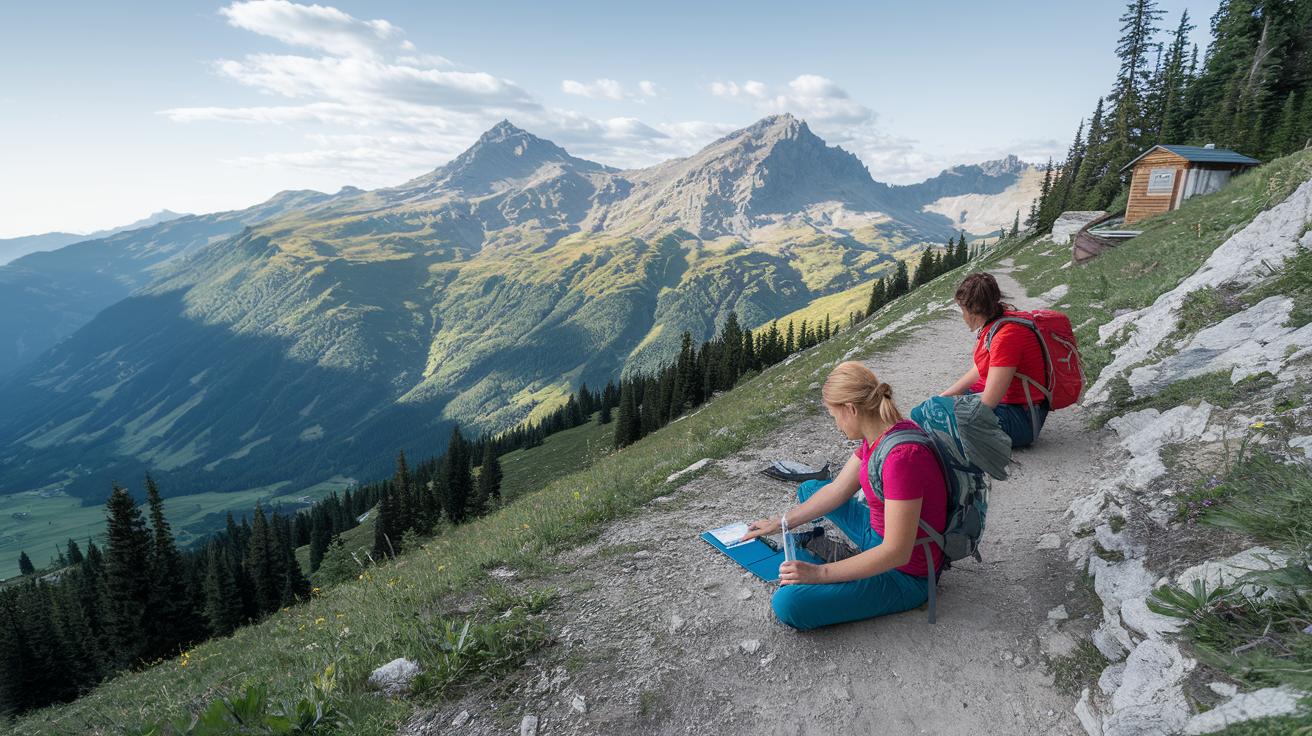
Foundational steps to customizing your hut circuit itinerary
Digital tools for building itineraries and importing GPX files are a real game changer when planning a hut circuit. Apps like Komoot and AllTrails Pro let you break a long trek into daily goals using GPX map files (files your phone or GPS uses). You can easily spot key landmarks, check distances, and note elevation changes. For example, you might see that your toughest day includes a 500-meter climb, and then adjust your pace to keep things comfortable.
Alpine huts usually run from mid-June to late September. They often take bookings up to six months ahead through online systems. Breaking your hike into smaller days helps you schedule rest stops and avoid overly long, tiring journeys. This approach keeps each day manageable and fun.
Here are some steps to get started:
- Decide your daily goals, like setting a target of 10 km (6.2 mi) for a steady pace.
- Choose a region that fits your interests and fitness level.
- Use GPX tools to mark daily distances, set checkpoints, and plan your time.
- Book your hut stays early to secure a bed, meals, and any extra services you might need.
Keep your schedule flexible by checking live weather updates and elevation insights from your apps. Adjust your daily goals if weather changes, like if a sudden shower or an early snow hit your route. This way, you can update your itinerary quickly and have a smooth, enjoyable adventure.
Hut circuit itinerary route selection strategies

Hut circuits are spread across many regions. You may explore mountain areas like the Dolomites, Switzerland, Austria, and France. There are also routes like Scotland’s Great Glen Way, Norway’s fjord country, New Zealand’s Great Walks, Nepal’s teahouse treks, and even Kyrgyzstan’s Tian Shan. Each region has its own type of landscape and hut style. When planning your hike, think about the trail distance, changes in elevation, and what each hut offers. For instance, if you have a steep 600-meter climb over a 10-km stretch, expect to slow down and take extra breaks.
Key criteria for route selection
Check the route details such as the total distance and elevation gain. Look at the hut types too, whether they offer shared dorms or private rooms. Also, consider options like half-board meals or packed lunches, which can really help maintain your energy on the trail.
Balancing challenge and support
Pick a route that matches your fitness and supports local businesses. This means choosing trails that offer a good mix of challenge with reliable shelter along the way. Consider these points:
- Daily walking distance
- Amount of elevation gain
- Hut facility type and size
- Remoteness and access to services
- Season and weather conditions
Adjust your plan to keep each day fun and manageable while exploring different mountain settings.
Cabin booking preparation within your hut circuit itinerary

Booking in advance is the best way to secure your bed and services. Huts often take reservations from mid-June to late September, up to six months ahead. Adding these details to your digital itinerary makes planning simple.
Here’s what to do:
- Pick huts that fit your route and budget.
- Check the booking dates to match your travel plans.
- Look at the hut features: shared dorms, buffet breakfasts, multi-course dinners, or packed lunch options.
- Confirm your booking by reviewing cancellation rules, available spaces, group discounts, and luggage-transfer services.
Write down each hut’s address, phone number, and meal times in your travel notes or digital file. For example, jot the hut’s phone number next to its meal schedule so you can call quickly if plans change.
Scheduling and optimizing daily trek segments in your hut circuit itinerary

Start by setting daily goals that match your fitness and the trail’s challenges. Many beginner hut circuits take five days or less. Aim for about 10–15 miles a day (16–24 km) and adjust if there are steep climbs or rough patches.
Itinerary builders can help by automatically placing hut stops and suggesting good rest spots. This gives you time to rest, recharge, and even enjoy a scenic detour if the weather changes.
| Day | Distance (mi) | Elevation Gain (ft) | Rest Stop |
|---|---|---|---|
| Day 1 | 10 | 800 | Streamside Clearing |
| Day 2 | 12 | 950 | Sunny Meadow |
| Day 3 | 14 | 1100 | Lakeside Rest |
| Day 4 | 13 | 1000 | Wooded Hollow |
| Day 5 | 10 | 750 | Village Square |
Adjust your plan based on how you feel and the actual trail conditions. Set aside extra time for weather delays or a surprise detour. Each day, take a moment to note what worked best, so you can fine-tune your route and enjoy a steady, relaxing pace.
Seasonal adjustments for your hut circuit itinerary

When planning your hut circuit, match your travel dates with when the huts are open. Most huts welcome guests from mid-June through September. Booking during these months helps you avoid surprises. Shoulder seasons might mean fewer people but also a chance of late snow and limited services. Always check local avalanche forecasts (warnings about snow slides) and use weather apps that include elevation details to stay safe.
- Confirm the hut dates and operating times.
- Keep an eye on snow risks and avalanche warnings, especially at the start and end of the season.
- Plan for shorter daylight hours that might change your hiking times.
Build a flexible schedule by including extra days. This buffer gives you time to adjust if storms, route closures, or unexpected weather delays happen. Enjoy your hut circuit with peace of mind.
Safety protocols for your hut circuit itinerary

Traveling in the backcountry can be risky, so it's important to have clear safety steps in place. Always pack a map, a compass, and use GPS apps on your phone. Download offline maps from Gaia GPS or BackCountry Navigator, and bring extra batteries or a power bank. Early in the season, include avalanche gear like a beacon, shovel, and probe. A group first-aid kit is essential, and assigning clear roles for navigation and communication keeps everyone connected.
- Route briefing: Meet with your group to review the day’s route and any hazards.
- Emergency gear: Double-check you have all vital tools, including your first-aid kit and avalanche safety equipment.
- Communication plan: Decide on how to stay in touch, whether by digital apps, radio, or satellite devices.
- Check-in schedule: Set specific times to call or message someone off-trail to confirm everyone's safe.
- Weather checks: Keep an eye on live forecasts throughout the day, especially for sudden changes.
While on the trail, pause to re-assess your plan based on the actual conditions. If the weather shifts or unexpected obstacles appear, regroup quickly and reassign roles to help keep your hut circuit safe and enjoyable.
Digital and analog tools for your hut circuit itinerary modifications

When you're adjusting your hut trip on the go, mixing modern apps with classic paper tools works best. Digital apps help you change your plan in real time, while a paper map and compass keep you safe when there's no cell signal. This mix prepares you for sudden weather shifts, quick snow alerts, or spotty reception.
Best digital platforms
- Komoot – Import GPX files and view slope shading even offline.
- AllTrails Pro – Read live reviews and see an offline satellite view.
- Gaia GPS – Check detailed hill views to understand the terrain.
- Relive – Watch 3D route videos for a clear preview of your path.
Analog methods for backup
When tech fails, a paper map and compass come to the rescue. Draw your route, note key landmarks, and keep a printed copy of your plan. Hikers have trusted this method for years because it works even when digital tools don’t.
Using both digital and paper tools gives you a flexible plan. Digital apps let you export your route as a PDF or CSV and even add weather updates for sudden changes. Meanwhile, your paper map stays as a reliable guide. Together, they form a strong system that helps you adjust quickly on steep climbs or unexpected detours, so you always know where to go.
Final Words
In the action, we explored how digital tools and GPX files can simplify route planning, cabin booking, and even safety checks. We broke down how to map daily distances, check weather details, and adjust plans based on seasonal shifts. With these clear steps, customizing your hut circuit itinerary becomes straightforward. Enjoy the balance of planning detail and the flexibility to adapt on the go. Every step builds confidence and a sense of mountain connection for a truly uplifting hut-to-hut experience.
FAQ
How do I customize my hut circuit itinerary with digital tools?
The customization process uses digital itinerary builders and GPX file imports in apps like Komoot and AllTrails Pro to segment long treks into daily targets for a smoother hut circuit plan.
How do I choose the best route for my hut circuit itinerary?
The route selection process considers factors like trail distance, elevation gain, hut amenities, and terrain difficulty to match your fitness level and ensure comfortable support along the trek.
How should I prepare for booking cabins on a hut circuit?
The cabin booking plan involves checking online reservation windows, comparing hut features, reviewing cancellation policies, and securing confirmations early to guarantee a spot during the operating season.
What tips help optimize daily trek segments on a hut circuit?
The daily trek optimization involves setting realistic mileage targets, factoring in rest breaks and weather delays, and using digital planners to adjust distances and maintain a steady pace along the route.
How can I adjust my hut circuit itinerary for seasonal changes?
The seasonal adjustment process means aligning travel dates with hut operation windows, watching for late snow and limited services, and adding buffer days to cover unexpected weather conditions.
What safety protocols should I follow on a hut circuit?
The safety plan involves carrying a map, compass, and GPS-enabled apps, packing essential emergency gear, scheduling regular check-ins, and assigning roles to ensure clear communication during the trek.
Which digital and analog tools are best for updating my hut circuit itinerary?
The best approach is mixing digital apps like Komoot and AllTrails Pro for live updates with paper maps and a compass as reliable analog backups when cell service is limited.
viagra pill strengths
viagra pill strengths
40mg cialis reddit
40mg cialis reddit
vidalista 60 for sale
vidalista 60 for sale
dapoxetine tadalafil combo
dapoxetine tadalafil combo
finasteride therapeutic classification
finasteride therapeutic classification
sémaglutide naturel
sémaglutide naturel
semaglutid oral dosierung
semaglutid oral dosierung
vardenafil online canada
vardenafil online canada
acular ketorolac reference page
acular ketorolac reference page
toradol migraine relief instructions
toradol migraine relief instructions
toradol how long it lasts
toradol how long it lasts
ivermectin demodex treatment evidence
ivermectin demodex treatment evidence
ivermectin rosacea evidence
ivermectin rosacea evidence
ivermectin scabies medical summary
ivermectin scabies medical summary
PDE5 inhibitor online safety
PDE5 inhibitor online safety