

Do maps with long distances and steep climbs make you nervous? Planning a hut circuit is easier when you know the basic numbers. When you understand the distance (in km and miles) and the vertical gain (in m and feet), your long trek feels more comfortable.
Think of it like solving a puzzle. Each piece, each climb, brings you closer to a warm, handy hut. We break down the route into simple numbers so you know exactly where each step leads.
This careful planning makes the whole trip safer and more enjoyable. Read on to learn how to set up your hut circuit with ease and confidence.
Hut Circuit Elevation Profiles & Distance Breakdown

When mapping out a hut circuit, it's smart to start by measuring the total distance and adding up all the climbs. This gives you a clear picture of your vertical challenge. For instance, the Seiser Alm Circuit is 29.5 km with 1,311 m of climbing, the Rosengarten Route covers 26.7 km with 968 m of gain, and the Drei Zinnen Trek is about 14.85 km with 671 m of climbing. These examples show you how to work out the full journey.
Most closed-loop hut circuits come in between 80 km and 160 km (50–100 mi). Breaking the hike into daily chunks helps you balance the long distances and the steep climbs. Typically, you can plan for daily segments of 7 to 12.5 miles so that each day feels doable with steady efforts.
Keep key landmarks in mind, like the John Gardner Pass at roughly 3,120 m, which is a major milestone on many routes. Checking the gradient (how steep the trail is) can help you decide if you need to adjust your pace or schedule.
For practical planning, consider these steps:
- Use trail maps and verified GPX files (map data for your phone or GPS) to measure the overall distance.
- Add up the elevation gains for each part of the trail.
- Plan daily segments that are comfortable and avoid overly tough days.
- Watch for high passes and steep spots and keep a steady pace there.
For more detailed hut-to-hut hiking logistics, visit the hut-to-hut hiking guide on hike2hut.com?p=260.
Mapping Techniques for Hut Circuit Distance & Altitude

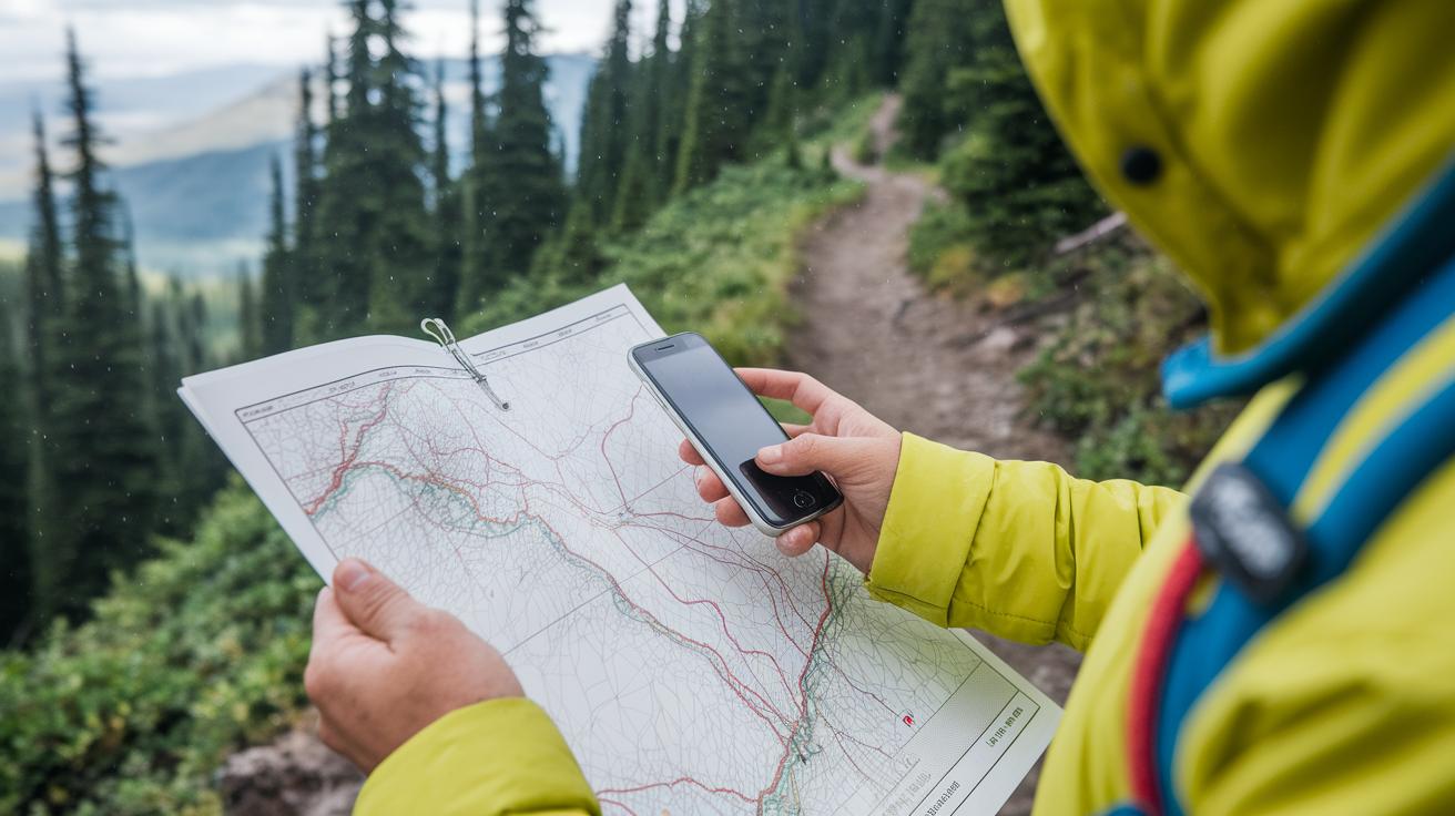
Learning to read your map is key for planning your hut journey. Topo maps (which show hills using contour lines) are your best friend. When the lines are close together, the climb is steep. When they spread out, the terrain is gentle. It’s like piecing together a puzzle where every line tells you something about the trail.
You can use both paper maps and digital tools. Offline GPS apps like the gps hiking app let you mark hut locations, track waypoints, and record elevation changes even when there's no cell signal. Digital mapping platforms show your route on Digital Elevation Models (DEMs), giving you a clear view of changes in height. Always check the map legend to be sure you understand the symbols and line spacing.
Using these tools, you can plan daily stages that match your pace. By combining map skills with practical GPS tracking, you get to know the climb ahead. This way, you can set a comfortable pace and enjoy every step of your adventure.
Daily Stage Planning in Hut Circuit Distance & Altitude

Planning your hut circuit in small, manageable chunks is key to a great trail experience. We suggest aiming for daily stops of about 11–20 km (7–12.5 mi). This mix of distance and climbs keeps you moving at a steady, enjoyable pace. For example, many hikers complete the Seiser Alm circuit in 3 days and 2 nights, while the Rosengarten route usually takes 4 days and 3 nights. The Drei Zinnen trek often wraps up in 2–3 days.
A simple six-step plan can guide you:
- Map your route with reliable trail data.
- Check the elevation changes (this shows you where the climbs are).
- Reserve hut spots in advance.
- Do a quick gear check and pack light.
- Study the weather to avoid surprises.
- Let someone know your plan for safety.
Most hut circuits cover around 8–15 km a day with climbs of 300–600 m. This setup gives you a mix of flat and steep sections. Huts usually run from mid-June to mid-September, so it’s a good idea to book your stay 6–9 months ahead.
These tips help you plan a circuit that is both realistic and fun. Setting clear daily goals means each stage feels doable, so you can relax and enjoy every moment on the trail.
Topographic Profile Analysis for Hut Circuit Elevation Planning
Knowing how to calculate the steepness of a trail is key when planning your hut circuit. To do this, divide the total climb by the horizontal distance and then multiply by 100. For example, if you climb 1,311 m over 29.5 km, the average gradient is about 4.4%. This quick math shows you how hard the trail is and points out sections that climb over 10%, where you should take extra care and slow your pace.
It also helps to look at the trail’s elevation chart. When contour lines are close together, the slope is steep. When they are more spread out, the climb is gentler. This way, you can easily spot where you'll need to save energy or put in more effort.
Studying the trail’s slopes lets you tell which parts need a steady pace and which offer a break. Checking the gradient often and doing these simple calculations will help you plan a safe and enjoyable hike.
Tools & Instruments for Accurate Hut Circuit Measurement

Getting your altitude right on a hut circuit starts with the right gear. A solid GPS receiver with a barometric altimeter (an instrument that uses air pressure to measure changes in height) gives you smart readings for every climb and drop. Many hikers also use digital altimeters or a well-calibrated smartphone to make sure their height data is spot on even in parts where cell service is patchy.
A good waypoint system is key for marking important spots along your hike, like where the hut is or a sharp turn in the trail. Recording these points helps you keep track of total distance and the climb you’ve done. It also helps to compare your numbers with local markers, like a hut’s altitude plaque, to be sure your tools are reading correctly.
It’s wise to pack backup gear too. Offline apps that use DEM data (digital elevation maps) and printed contour maps will still work when your battery is low or the signal fades. Some hikers also use advanced radar systems for live mountain weather updates. These tools help you adjust your plans when the weather shifts and might impact your altitude measurements.
Regularly checking and calibrating your instruments keeps your data reliable throughout your trip. For extra tips on keeping your tools in top shape, check out the mountain hiking trip planning tips at hike2hut.com. This careful approach not only helps you plan safe routes but also builds confidence on those challenging mountain trails.
Seasonal & Terrain Factors Impacting Hut Circuit Elevation & Distance

When planning your hut trip, the season and terrain shape your hike. Huts typically open from late June to late September. The best services are available from mid-July to early September. In early June or late September, there are fewer crowds, but you might still face snow on high passes.
The land itself plays a big role too. In the Verwall region, fog and light rain over grassy slopes can slow you down. In the Silvretta range, you’ll see amazing glacier views and waterfalls that make even a regular climb feel special. Over in the Rätikon area, worn trails and rugged limestone cliffs add a bit more challenge.
Always watch for sudden weather changes like hail, high winds, or thunderstorms. Adding extra time to your plans is smart so you don’t feel rushed if a storm starts.
Keep in mind that seasonal shifts can change trail conditions and available services. Use a good map and check the terrain carefully. This way, you can adjust your daily stages to fit your fitness level and fully enjoy the journey.
Final Words
In the action, we broke down route elevation and distance details using real examples and clear daily splits. We looked at mapping techniques, topographic profile analysis, and tools that help in planning hut circuit elevation and distance planning. The article gave you concrete numbers and practical tips to split your hike into manageable segments. Enjoy the crisp mountain air and the real thrill of setting out on a well-planned hut circuit. Keep safe and savor each step on the trail.
FAQ
Frequently Asked Questions
How do you calculate a hut circuit’s distance and elevation gain?
Calculating a hut circuit’s distance relies on measuring the total kilometers and the cumulative elevation gain in meters. For example, the Seiser Alm Circuit is 29.5 km long with 1,311 m of climbing.
How can mapping tools assist in planning hut circuits?
Mapping tools such as topographic maps and offline GPS apps help mark huts, waypoints, and elevation changes. They make it easier to plot the route and understand altitude variations for safe planning.
How do you plan daily stages on a hut circuit?
Planning daily stages involves splitting the overall route into manageable segments, typically 7–12.5 miles per day. This method uses both distance and elevation profiles to create balanced and steady hikes.
What role does topographic profile analysis play in hut circuits?
Topographic profile analysis charts elevation changes over distance. It reveals steep segments and gentler slopes, allowing you to adjust your pace and plan realistic segments for continuous progress.
What tools are recommended for accurate measurements on hut circuits?
The best tools include GPS receivers with barometric altimeters, digital altimeters, and calibrated smartphones. These devices help you record precise altitude readings and track distances between huts reliably.
How do seasonal and terrain factors affect hut circuit planning?
Seasonal and terrain factors impact route accessibility and safety. Changes in weather, trail conditions, or snow at passes mean you may need to add extra time and adjust your plans for a safe, comfortable experience.
tadalafil amazon india
tadalafil amazon india
generic cialis instructions
generic cialis instructions
stendra generico prezzo
stendra generico prezzo
doxycycline acne dose course
doxycycline acne dose course
liraglutide and semaglutide weight loss
liraglutide and semaglutide weight loss
ivermectin therapeutic overview
ivermectin therapeutic overview
ivermectin cellular mechanism
ivermectin cellular mechanism
minoxidil 2% vs 5% 12‑month comparison
minoxidil 2% vs 5% 12‑month comparison