

Plan Your Hut Trek with Digital Tools
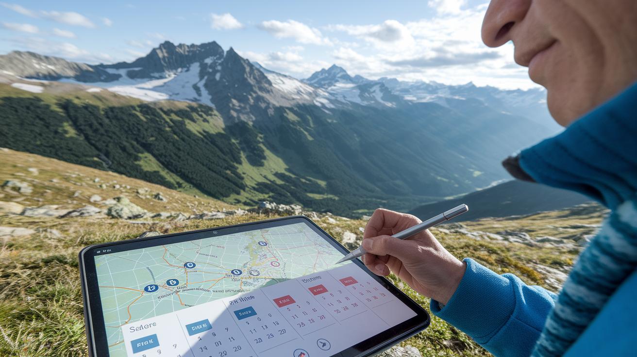
Ever wonder if your phone could simplify the challenge of planning a hut circuit? With apps that load GPX files (map files that work offline) into your favorite map app, you can break a long trek into easy, clear days. You can track each hill climb and rest spot along the way. Whether you choose AllTrails or Komoot, modern tech helps guide you safely through the mountains. This guide shows you how to use these tools to plan a hut-to-hut trek that is both safe and enjoyable.
Mastering Digital Tools for Hut Circuit Trek Planning

Choose a region that fits your energy and interests. Load your GPX files (the map files your phone or GPS uses) into a trusted offline map app. These digital tools give you step-by-step guidance, show hill climbs in detail, and help you break a long trek into daily, manageable segments.
Apps like AllTrails, Komoot, and Relive offer clear directions for well-known hut circuits. For example, the Seiser Alm route covers 29.5 km with a climb of 1,311 m, Rosengarten spans 26.7 km over 4 days, and Drei Zinnen covers about 14.85 km in 2 to 3 days. They let you easily switch between your phone and tablet, and a cloud-based planner saves your custom plans online so you can update them on the go.
As you pick your map app, check out expert tips on using travel apps smartly. These tools help you measure daily distances, read elevation charts, and choose resting spots at mountain huts. They make it easy to tweak your plan if the weather changes or you decide to try a different path.
The best time to trek is from late June to late September when the trails are clear. For a quieter experience, consider early June or September when fewer hikers are around. With these digital solutions, you can plan a safe, efficient, and fun hut-to-hut trek while staying connected every step of the way.
Evaluating Hut Trek Planning Software: Feature Comparisons and Pricing

Planning a hut trek? Choosing the right tool can set you up for a smooth journey. We looked at popular choices like AllTrails Pro, Komoot, and Relive. They offer simple pricing plans and handy features that work well for any hut trek circuit. Plus, you can export GPX files (map files your phone or GPS uses) and use the apps on different devices.
| Software | Price | Key Features |
|---|---|---|
| AllTrails Pro | $5/month | Offline maps, live map layers, GPX export |
| Komoot | €3.99 per region or €29.99 for Europe unlimited | Region-specific planning, strong offline support |
| Relive | Free with a $20/year premium option | Basic route creation with upgrade for 3D recap videos |
These tools provide a solid base for safe and easy trekking. They let you plan your route in detail while staying flexible if the trail changes. Garmin wearable integration adds extra support by showing you finish times and sending altitude sickness alerts using smart AI. This helps you keep an eye on your condition during steep climbs. Compare based on what you need for your next hut trek.
Designing Trek Itineraries with Digital Hiking Itinerary Builders

Get the most from the builder’s export tools. Start by importing your GPX file (a map file your phone or GPS uses). Then plan your trek by setting daily distances and choosing hut stops that offer half-board meals. You can save your plan as a PDF or CSV file so it’s easy to share or keep a backup.
Use the built-in elevation check with Google Maps AI to spot and adjust any steep sections. When your plan is ready, book your hut stays online and enjoy a well-planned mountain adventure.
Offline Route Mapping Solutions and Remote Trail Mapping Apps

When cell service fades, offline map apps become your best friend. Apps like BackCountry Navigator and Gaia GPS let you load GPX files (the map files your phone or GPS uses) so you can see clear topographic and satellite views. They even add slope shading to flag steep climbs before you get there.
These tools let you overlay extra details like elevation contours and trail markers. Regional map packages may be 200–500 MB, but they offer the accuracy you need for planning a smooth hut circuit trek. You can also mark waypoints along the trail, noting important turns or rest stops along your route.
Digital mapping systems now offer easy waypoint marking that syncs with the cloud. This means if the weather shifts or you need a new route, you can update your plan without starting over. An offline mobile GPS app makes sure you always have a reliable path, even deep in remote areas.
Key features at a glance:
- GPX imports for precise trail data
- Topo and satellite layers for clear views
- Slope shading to highlight steep sections
- Offline tile caching to keep your maps handy without internet
These features help you plan a safe, dependable trek on any remote hut circuit.
Managing Hut Reservations with Digital Lodge Reservation Tools
If you're planning a mountain trip, note that most alpine huts open from mid-June to late September and many now let you book online. There are online databases listing over 1,000 huts in the Alps, showing real-time availability so you can lock in your stays up to six months ahead.
Some platforms let you plan your route while booking your hut. You can search for huts that offer half-board meals for about €80–€100 per adult, with roughly a 20% discount for kids. A handy feature is calendar sync to help you plan your nightly stops. Many tools also allow group reservations and flexible cancellation if your plans change or the weather turns.
For a hassle-free experience, try the mountain hut booking engine. It brings all these features together in one place, so you can manage your bookings easily and focus on enjoying your trek.
Leveraging Real-Time Weather and Elevation Analytics in Circuit Trek Planning

Digital tools now let us plan hut circuits by blending weather and elevation data into one smart package. These apps pull live forecasts that help you watch for early snow, lightning, or sudden storms. For instance, one tracker shows an elevation profile much like the Seiser Alm climb graph, so you can spot steep parts and gentle slopes at a glance.
A digital elevation chart lays out the ups and downs along your route. This lets you check for high-risk slopes before starting your hike. And if the weather takes a turn, many tools suggest alternative paths on the fly. Here are some helpful features:
- Live weather feeds that warn you of dangerous conditions
- Clear elevation charts showing each climb and descent
- Alerts for risky sections and signals of changing weather
- Rerouting ideas to avoid tricky segments
Imagine checking your route and seeing a live update recommending a smoother path because clouds are gathering over a steep pass. Using these integrated systems makes multi-day hut circuits safer and easier to handle. With real-time weather and clear elevation data, you can quickly adjust your plans to match nature’s pace and your own energy.
Case Studies: User Experiences with Circuit Trek Planning Tools

Reddit posts from the Dolomites tell us that booking huts early and keeping your daily distances flexible makes a big difference on the trail. Hikers love using digital travel logs to capture every twist and turn of their journey. One trekker shared that Komoot's clear visuals made planning a multi-day route feel as simple as following a real-time trail map. Another hiker pointed out that AllTrails offers trusted reviews that help adjust plans on the fly. These real stories show that breaking a long trek into daily segments really takes the stress out of planning.
Some hikers also appreciate tools that log events and track changes in elevation. For example, one user told us that Gaia GPS tracked his four-day trek and measured his climbs with 98% accuracy. This helped him plan his daily distances and pick the best spots to rest. Key features often mentioned include:
- Digital travel logs that record each part of your hike
- Trek tracking metrics that let you adjust daily distances
- A multi-day planning module that breaks a long trek into easy, daily plans
- User-friendly trail maps and clear feedback
These experiences reassure us that the right digital tools make planning a trek simpler and safer. Real feedback like this helps all of us make smart decisions for our hut circuit adventures.
Final Words
In the action, we've seen how to use GPX files for offline mapping, plan daily distances, schedule hut stays, and track weather and elevation shifts. Digital tools for hut circuit trek planning give clear guidance and support from start to finish. They help you choose a region, set daily targets, manage reservations, and access live weather updates. These tools let you focus on the mountain and enjoy each step safely. Embrace this simple, low-stress process and have a great time exploring the peaks.
FAQ
Q: What is the best hiking mapping software?
A: The best hiking mapping software often includes apps like AllTrails, Komoot, and Gaia GPS as they provide route guidance, offline support, and detailed elevation profiles for safe and informed hut circuit trekking.
Q: Is Google Maps good for hiking?
A: Google Maps offers basic mapping features but lacks trail details and offline GPX support needed for hiking. It can serve as a backup, but dedicated hiking apps are more reliable in remote areas.
Q: Are hiking apps free to use?
A: Many hiking apps offer free versions with basic features. Advanced tools like offline maps, live tracking, or detailed route planning usually require a subscription or a one-time fee for enhanced functionality.
Q: How to make a hiking plan?
A: Making a hiking plan involves importing your GPX file, setting daily distances, scheduling hut stops, and exporting the itinerary. Digital tools help you customize routes, check elevation profiles, and plan for safe, memorable trails.